Drone mapping Courses
Explore instructor-led and hybrid programs aligned to practical Drone mapping use cases across industries.
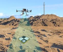
Available Drone mapping Courses
Showing 1-2 of 2 courses

10 days
Accra, Addis Ababa, Bangkok, Cape Town, Dubai, Istanbul, Kigali, Nairobi, Singapore
Training Course on Drone Operation and Data Analysis for Agricultural Applications
Training Course on Drone Operation and Data Analysis for Agricultural Applications is meticulously designed to equip agricultural professionals, drone enthusiasts, and environmental analysts with hands-on skills in UAV (Unmanned Aerial Vehicle) piloting, aerial imaging, and spatial data interpretation.
Training Course on Drone Operation and Data Analysis for Agricultural Applications is meticulously designed to equip agricultural professionals, drone enthusiasts, and environmental analysts with hands-on skills in UAV (Unmanned Aerial Vehicle) piloting, aerial imaging, and spatial data interpretation.
5 days
Accra, Addis Ababa, Bangkok, Cape Town, Dubai, Istanbul, Kigali, Nairobi, Singapore
Training Course on Georeferencing and Mapping Accuracy with Drones
Training Course on Georeferencing and Mapping Accuracy with Drones equips participants with the essential knowledge and practical skills to confidently plan, execute, and process drone-based mapping projects, ensuring the highest levels of data quality and spatial integrity
Training Course on Georeferencing and Mapping Accuracy with Drones equips participants with the essential knowledge and practical skills to confidently plan, execute, and process drone-based mapping projects, ensuring the highest levels of data quality and spatial integrity